


Digital Mapping
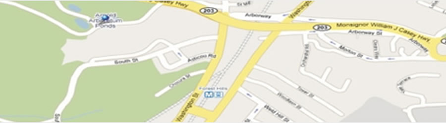
The world is made up of countless millions of roads, from huge motorways to quaint country lanes. Finding out where your vehicles are, or sharing your trips with others, adds a whole new dimension to travelling. GPS Digital Mapping technology is an effective across border support which enables highly detailed visual location updates to help with monitoring all areas, from driver safety to real-time traffic. Thingonet offers Digital Mapping tailored to suit individual needs.
Thingonet provides multi-map support like Google Maps, Bing Maps, Navteq and Teleatlas for tracking the position of your vehicle. Along with street address, you can also view the distance from any user defined landmarks or find vehicles close to a particular address. All trips of the vehicle are plotted on the map and this historical data is available for your analysis.
Thingonet’s GPS Digital Mapping Software feature enables you to:
- Quickly find the exact location of vehicles by grid reference or place name search
- Easily find, plot, assess and print your route
- Create your own personalized maps with custom geo-zones and landmarks
- Real time traffic updates with notifications & alerts via email or SMS
- Instantly display the relevant map on the screen
- View the historical data of all trips including distance, total travel hours, estimated time and other statistics
